
Day 2 of my Cape Scott hiking trip in 2015.
Hiking to Guise Bay
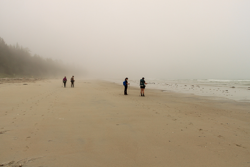
The morning started out completely fogged in. We couldn’t see much. Oh well. Let’s go to the lighthouse anyways. It might clear up when we get there.
The weather was warm and dry. I wasn’t complaining. A wet day dampens the spirits.
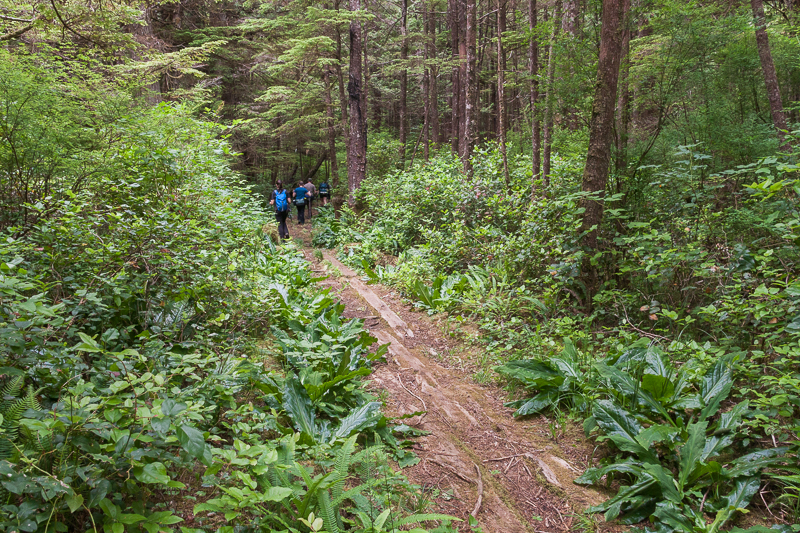
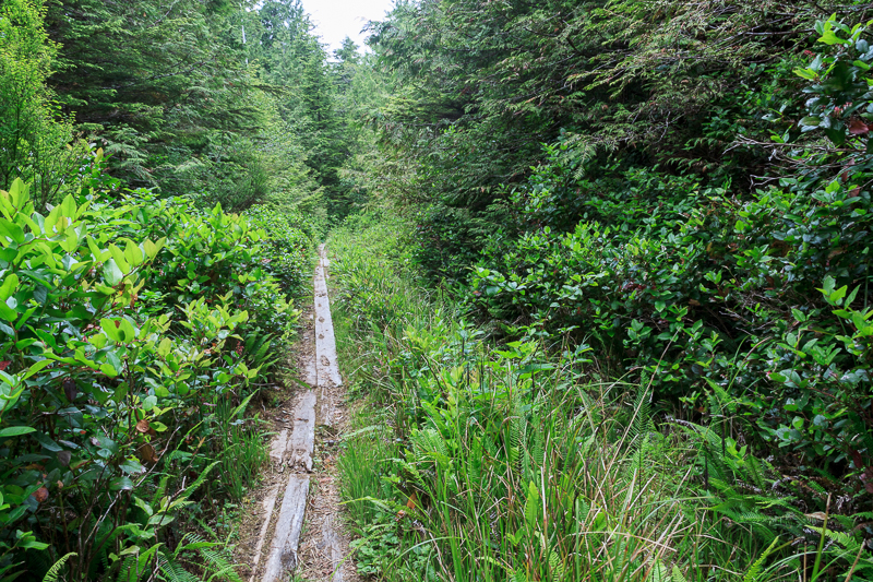
The forest is so lush.
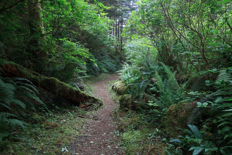
We followed the path in from the beach along the old log roads.
We were much lighter today, only carrying the food and water that we needed to do the 12km return trip from Nels Bight to the lighthouse. Sore, tired legs from the 20 km the day before made for slow going but we didn’t have to deal with full packs.
The ground wasn’t flat. Duh. Hiking trails aren’t sidewalks but I assumed with the lack of elevation around Cape Scott that it would be easy hiking. Even though where wasn’t much elevation gain, the old boardwalk was full of holes, missing chunks here and there. Some of it was just dirt, wormed with roots, between a patchwork of old boards.
Aside from the old road boards in the dirt, this could be anywhere on Vancouver Island, packed with green ferns and salal. I caught my mind wandering thinking I had seen it before. Obviously not. This was my first trip to Cape Scott.
The trail heads into the woods from Nels Bight to the east half of Experiment Bight.
Guise Bay
From the east half of Experiment Bight we left the sand to the woods for a kilometer to pop out on Guise Bay. Guise was my favourite scenes of the trip. I could have stayed there the entire time, just relaxed and taken in the view.
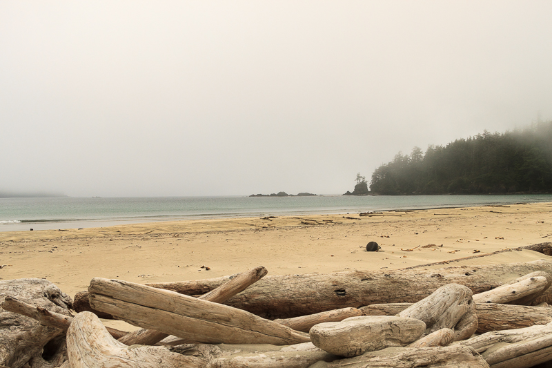
The sand was a more golden colour than Nels and the water more blue. It looked tropical when the sun hit it right. There were 3 groups camped there but far fewer than Nels.
Guise is another 3 km farther along the trail from Nels. It’s a full 20km in from the parking lot. I was happy to stop at Nels when we did. Taking all your gear 3km further to camp at Guise is just more work. It might be worth it if like it better and planned to spend a few days there.
After Guise Bay, the trail heads back into the woods and gains the elevation up to the lighthouse. There is just over 2km of trail from Guise up to the lighthouse. 30 minutes if you’re hiking about 4km/hour. With breaks we were moving about 3km/hour.
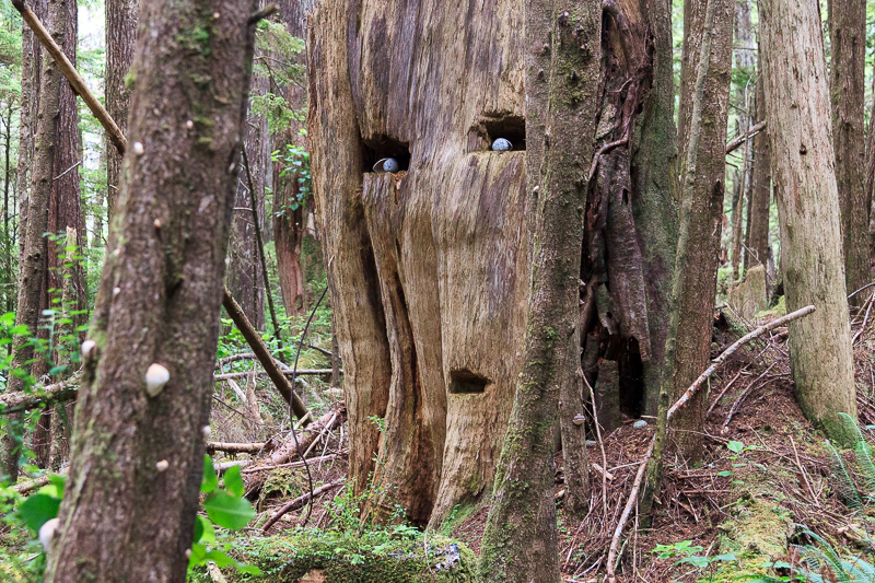
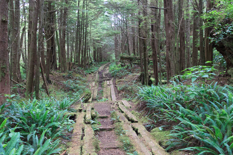
Relics of old logging in the area, springboard holes in one of the trees made an art project for someone coming through. The seashells around the stones to add depth to the eyes. I admired such attention to detail. Obviously I’m not an artist. Most of the trail from Guise to the lighthouse was some type of old road. Some was just logs placed across the road and others were planks parallel to the trail.
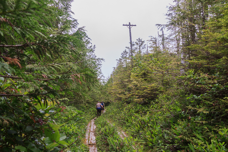
The odd thing in this scene was the old hydro (telegraph line?) pole.
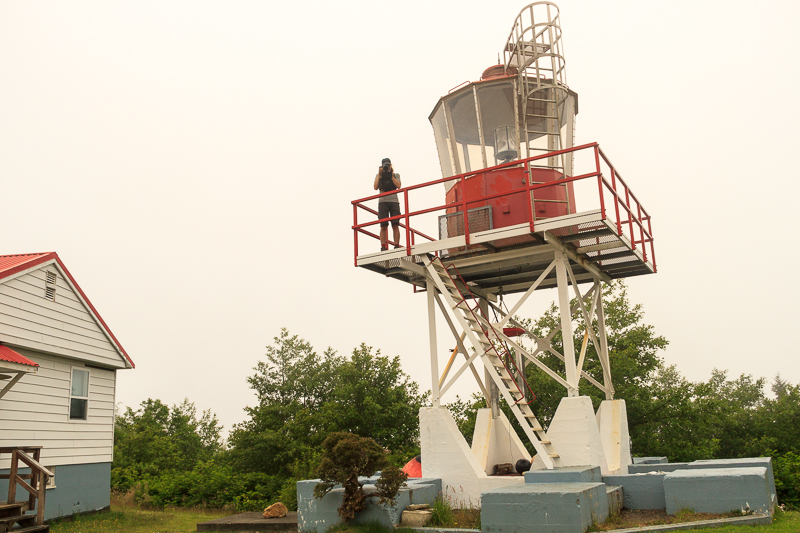
Cape Scott Lighthouse
We trudged up the dirt road to the Cape Scott lighthouse. There was a small that lead down to the water on the right as we were coming up the road. We later learned that this lead down to the fuel tanks previous location. Thanks to a fuel spill years ago, regulations changed and they had to have their fuel further away from the water.
Obviously I needed to have a picture of my friend Bryn taking a photo on every trip. I don’t think there’s a photo on this blog where you can actually see his face. We’ll just call him the cameraman.
We couldn’t see a thing through the clouds and the fog. I’ll be back one day to enjoy that view for sure. We can’t even see the water that surrounds the point we’re on. We can just see up to the lighthouse and that’s about it. The lighthouse keepers have brought a little puppy named Hurricane. His black and white fluffiness was vibrating with excitement with visitors. They didn’t let him out to play thought, sometimes he runs away.
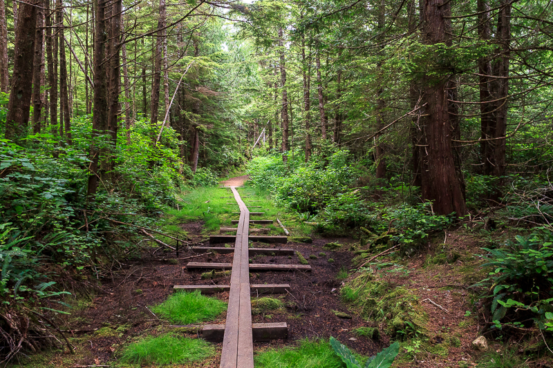
Satisfied (or not?) we won’t see any water from the lighthouse, we turned to head back to base. One of the buildings had treated rainwater for drinking from a tap. We filled up our water and wandered back down the dirt road. Back into the lush green forest, onto board walks and old roads.
Some of the boardwalks are recent and made for hikers to manage the mud.
Other boards are remnants of old roads.
Back to Guise Bay
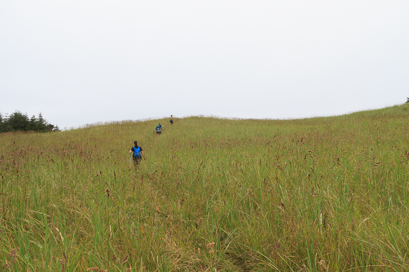
The sand dunes between Guise Bay and Experiment Bight was the most interesting place I saw on the trip. Vancouver Island doesn’t have much for big sand dunes. I’ve only seen them in New Zealand and on the coast of Oregon. Such an interesting view to pop out of thick coastal forest and see giant sand dunes from bay to bay across the cape. The top of the dunes don’t see much sea water, leaving them covered in tall grass. I thought I might see a little dinosaur running through the grass beside me.
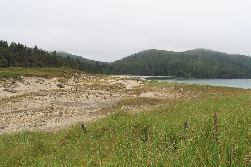
Part of the dunes get washed away in the winter with storms as they come pounding down on Experiment Bight from the north. Guise Bay is much more sheltered and protected. The thick grass stops at the edges where the waves have eroded a path through. Small patches have sprouted in the sand at the bottom. I’m sure they wash away every season during the storms.
Guise Bay
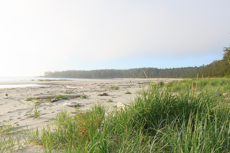
Experiment Bight
Experiment Bight has a much more desolate feel to it than Guise Bay. It’s just on the other side of the sand dune but it could have been on the moon. Not nearly as inviting. It would be quite the place for storm watching if you were (un)fortunate enough to be here when the wind and seas picked up. You might need the white hard hat sitting on the orange buoy below.
Each little trail section had its own own personality. Some looked like they were from their own planet. Others, like this one full of ferns, salal and salmon berries, could be from anywhere on Vancouver Island. Hiking just a few kilometres along the trail, you’d see all sorts of scenery.
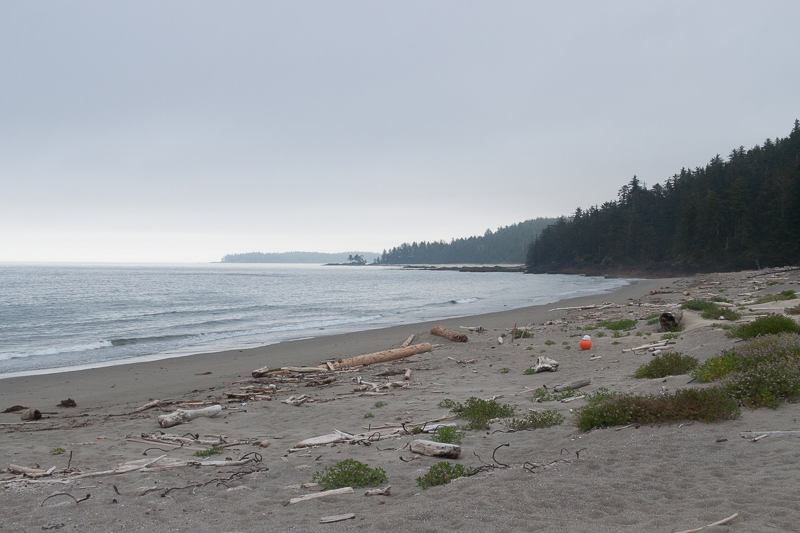
Nels Bight
A little over 12km there and back and we were home on Nels Bight. The weather brightened up for us after we got close to camp. Nice of the weather to break just as we get back to camp.
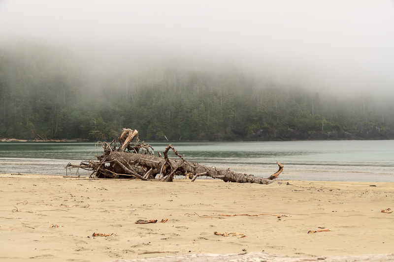
With the nice weather coming in, I spent the evening wandering the beach near camp. With all the tales of crazy things washing up on the beaches, I expected to find more garbage and treasures there. There was a small amount but not nearly what I’d thought. Nels is a busier beach with the ranger cabin on it so it must be regularly cleaned by rangers and beachcombers. Would the less frequented beaches have the more interesting garbage still lingering?
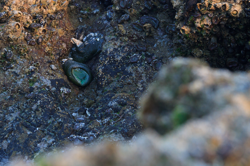
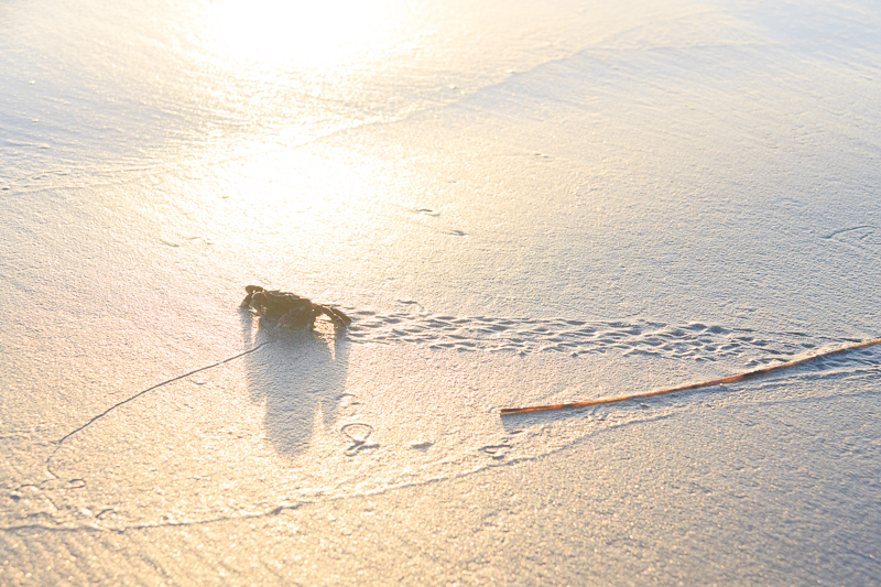
Coastal creatures.
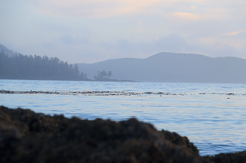
Looking back towards Experiment Bight from Nels.
Getting a little suntan in.
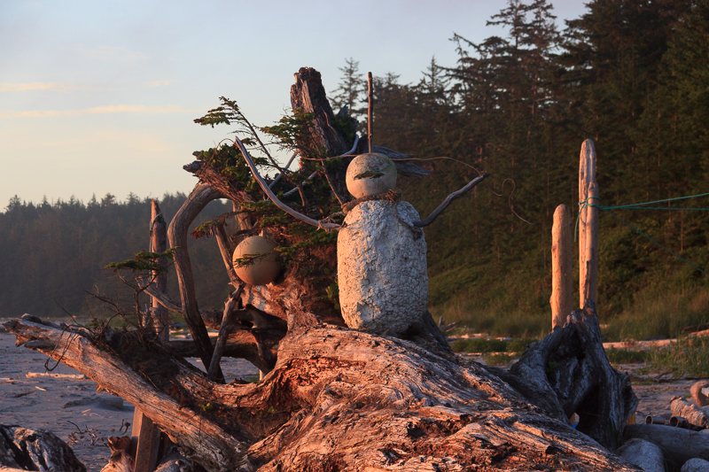
What else do you do with flotsam and jetsam sitting around? I’m not sure if he’s scary or inviting.
We got many comments from passers-by.
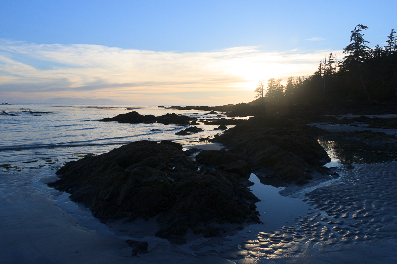
Sun setting on our second day in the park.
My legs and feet were toast from hiking but all I can do is smile looking out over the point to the sunset. There’s nothing better than relaxing with friends on a beautiful beach kilometers from any city in the warm evening.