
Note from Ross: Is it time to ski yet? Maybe not but we can still read and daydream about the months to come shredding powder.
Here’s another trip report from Roxy from Adder Mountain in May.
**
Adder Mountain May 6 2012
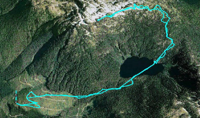
After heading up 5040 Peak the weekend before, our eyes were now set on Adder Mountain which was just down the valley from 5040. The weather looked great for Sunday so we hoped to get some views of the surrounding peaks which we never got to see the weekend before. We had spent the week looking up route information, trying to find out if anyone ever accessed the summit from Louise Goetting Lake which seemed like an obvious route. It seemed most people went up the Northwest Ridge, accessed from Sutton Pass on HWY 4, but the route did not look too appealing. The other option was to come in from the Nahmint valley and gain the East Ridge, but we knew that the road would be well snowed in at this time of year. So we made up an approximate Google Earth track which accessed Louise Goetting Lake from Spur MC30 off the Marion Creek Main, crossed the lake and went up onto the East Ridge to the summit.
Similarly to last weekend, we departed Victoria on Saturday night, driving up Spur MC30 only to find a gate at about 300 m elevation. Even though the elevation was similar to where we were bunked last weekend, the snow line looked to be nowhere near in sight. We set up our car camp for the night after admiring the nearby micro-hydro operation that was the reason for the gate’s existence.
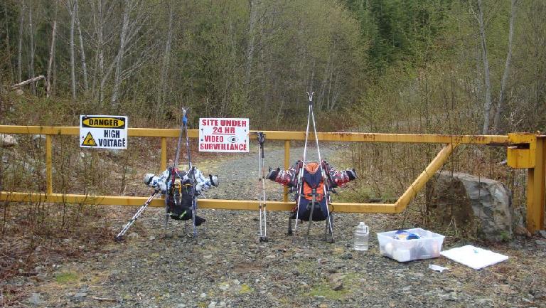
The next morning we started hiking around 6:15 am, admiring the morning alpenglow on Pogo Mountain and Triple Peak.
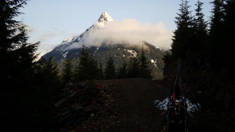
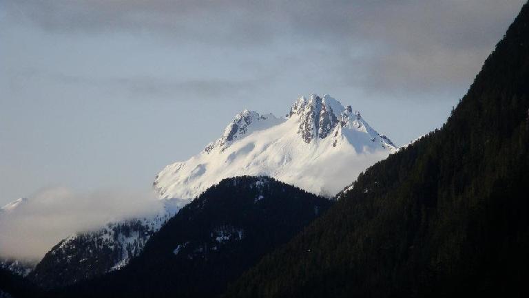
It turns out that the road we saw on Google Earth actually goes up much higher than the 12 year old satellite imagery. We put skis on at about 600 m and the road ends at about 650 m, at a micro-hydro station and spectacular waterfall. From there flagging for Jack’s Peaks starts and we followed it up to the lake, probably less than an hour from where the road ended. We had to take our skis off when the ground steepened, but it would probably be skinnable in softer conditions as we kept our skis on for the way out. Once at the lake, the flagging continues to Jack’s Peaks but we crossed the frozen lake aiming for the bluffy section on the northeast end of the lake. It looked steep, but we were able to skin up a drainage just to the west of the steep slopes which brought us to beautiful open forested slopes leading to the east ridge proper (Mt. Klitsa on the left, Nahmint Mountain on the right).
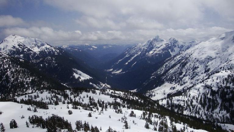
There was one slope blocking the east ridge which looked to be a high avalanche hazard, so we carefully ascended it one at a time. On our way down this slope later we both set off loose wet avalanches, nothing major but still a little scary.
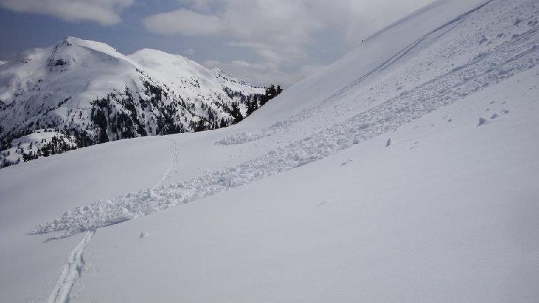
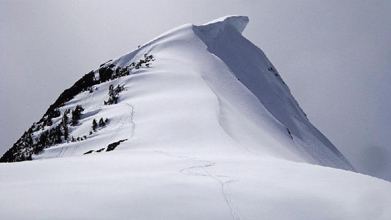
Just below the summit, we ditched our skis and bootpacked around the south to avoid the corniced and steep snow slope leading to the summit. I had a minor sketch moment traversing the top of the cliff in my clunky ski boots and crampons combination, but we were soon past any difficulties and were on the summit! Time to head back to some Cheetos and rum back at the truck =) A “huh” moment when skiing back onto Louise Goetting Lake from the steep drainage was had when I landed on the rapidly melting lake, and had my skis sink in to water. I don’t think we would have been able to get to the shore from that spot had we crossed late in the day!
Turns down were somewhat interesting since the snow was so slushy, and not yet consolidated, resulting in us setting off mini-avalanches whenever we cut a turn in. We were more just eager to get off the unstable slopes and we saw a couple of large avalanches thunder down Adder’s south face when we were returning across the lake. I kept thinking of something a colleague had once told me: “Sometimes avalanches onto frozen lakes are large enough to initiate lake ice break-up”. Those Cheetos and rum will be delicious!
Our GPS track up and down Adder Mountain:
** Roxy Ahmed is a graduate student at UVic who probably spends more time in the mountains than she should. On any given weekend you can find Roxy climbing or skiing the mountains of Vancouver Island and beyond.