
Note from Ross: I posted Roxy’s Mount Brenton trip report a couple weeks ago during the heat of the summer but now that the summer’s over (is it?) it’s time to get into some skiing!
Here’s Roxy with a trip report from 5040 in April.**
5040 Peak April 29 2012
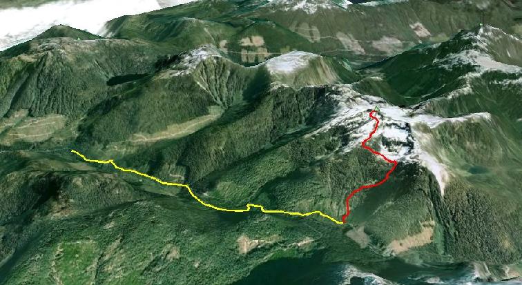
Chris and I were aching to do a ski tour and get into the alpine so we settled on 5040 Peak in the HWY 4 area for the weekend’s adventure. We drove up from Victoria on Saturday night, hoping to drive up the Marion Creek Main until we hit snow line and set up camp for the night. There are two main approaches to 5040’s summit; the Northwest Ridge which starts at about km 6 at the hydrometric station on the Marion Creek Main, and the much nicer looking Cobalt Lake route which starts at about 9.5 km and is the route we wanted to go up. Unfortunately, we hit snow at about 3.5 km and so we had to set up camp there for the night (the snow line was super low on the western side of the pass, down to about 200m!). So this meant that doing the Cobalt Lake route would add an extra 6 kms each way and over 300 m of extra elevation gain. Oh well, at least we had skis so the way out wouldn’t be so bad!
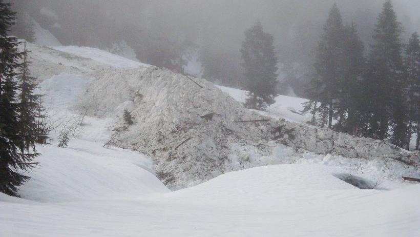
We started skinning up the road before 7 am to help contend with the extra approach. The sun peaked out for a few brief moments but then decided to keep us in a fog for the rest of the day. After a couple of hours, we reached the end of the road and the welcome sight of this huge avalanche runout coming out of the gulley parallel to the one we were about to head up. Good thing we had avalanche gear?
It was a bit tricky finding the flagging for the Cobalt Lake route but we weren’t too concerned since it was pretty much just head up the drainage staying on the south side of the creek. Chris did locate the flagging however, and soon we were hiking up slash and then steep forest for about an hour before we hit beautiful open old growth forest and we were able to put our skis on. We didn’t need ice axes or crampons to boot up the steep bits, but if it froze the previous night and the snow was hard I would defnintely recommend having that gear.
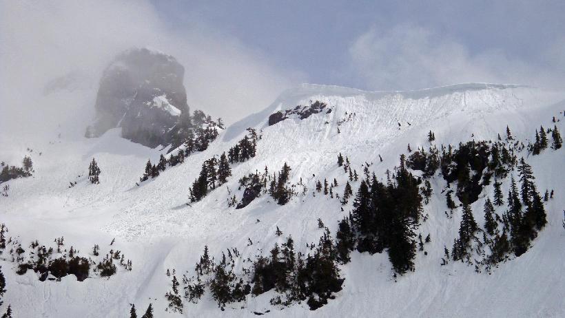
Once we got to Cobalt Lake, we stopped for a quick lunch and we were lucky enough to have the fog lift for just long enough to let us see our objective and pick out a route. It seems that most parties (especially in the summer) head around or across the lake east to a bench which gives easy access to the southern part of the summit ridge. However there was lots of avalanche activity in the basin and some suspicious cornices so we decided to head north into the trees, staying far left of the cliff band. This small ridge popped us onto 5040’s west face directly below the summit.
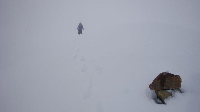
From there Chris decided to cut large switchbacks and skin up to the summit, but it was a little steep for my ready-for-retirement skins so I bootpacked the final 50 m or so to the top. This photo of me coming up onto the summit gives a good idea of what the conditions were like – no views that day. Once at the cairn that was apparently the top, we put on jackets, had a quick snack and turned to descend. Since we had no idea what the runout was like, Chris decided to walk his skis down to where I left mine since he didn’t want to risk a bail on the steep part. It was very weird and disorienting skiing through the whiteout in terrain you didn’t know! We stuck close together and didn’t open up until we got back to the relative safety of the trees. From there on it was fanatastic turns down! I would definitely go back, but maybe later in the season when the logging road approach wouldn’t be so long 😛
Our approximate route in red, and logging road hike to 5040 Peak:
** Roxy Ahmed is a graduate student at UVic who probably spends more time in the mountains than she should. On any given weekend you can find Roxy climbing or skiing the mountains of Vancouver Island and beyond.