
Outdooractive is a GPS app for your phone focusing on European content but spreading into North America as well.
The app is free to download on any iOS and Android phones and there are paid Pro and Pro+ versions for download.
Download for iOS
Download for Android
The website can be used to view routes and make your own as well. There are many articles about hiking, running, and cycling as well but focused on Europe at the moment.
Outdooractive bought the ViewRanger app a couple years ago and is implementing it’s features like BuddyBeacon and Skyline.
The app and the website have 3 main purposes: finding routes and tracks, tracking your hike on the trail and planning your hike at home.
Finding Routes and Tracks
With the Outdooractive app (website too) you can search for routes and follow them on the trail.
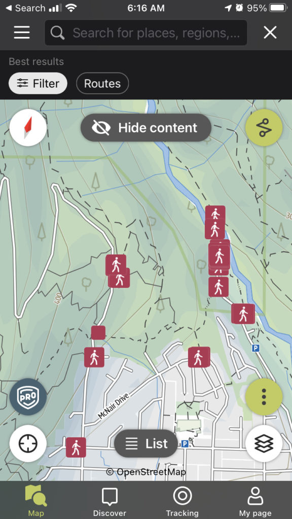
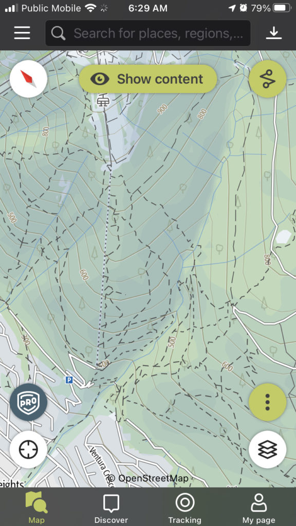
The Map section can show all the trails in the your area. You can focus on your area or scroll to any other area nearby. The Show and Hide content button will show all the routes that are available in that area. Clicking on a route will show you some details about it, some photos if there are any and the track of the trail on the map.
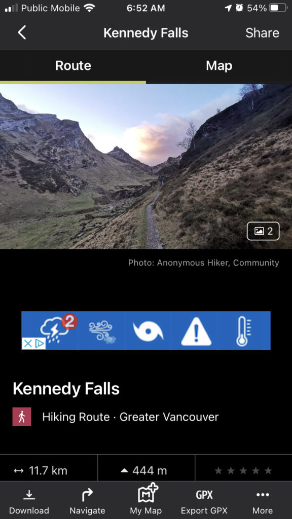
Clicking on a trail marker brings up a summary and then tapping again brings up the trail details with photos, a description, the distance of the trail and the elevation along the trail. Buttons along the button let you download the GPS track, start navigating on the trail or save the trail to ‘My Map’ (Pro feature) to see later.
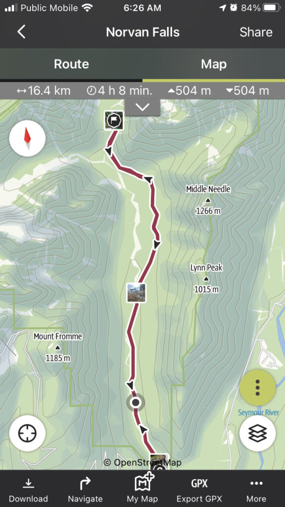
The map tab shows a topographic map with waypoints or photos taken along the way. I love when the maps show waypoints and photos along the way. It’s easy to see where the best photos are from right on the map. Are they at the end of the trail? Are they in the middle or right at the start?
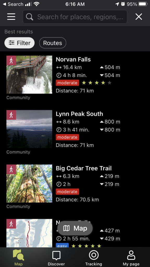
The list view is more of a text-based search of the trails. You can search for locations and then see the nearest trails. The list and map let you filter by easy/moderate/hard, distance to hike, distance from you, duration, ascent, and special features.
Tracking your hike or ride with Outdooractive
Outdoor active lets you track your own hike and add photos and waypoints. Obviously this is just in the app and not on the laptop website. When you are starting your hike, just press the Tracking button at the bottom then Start. It will use the GPS in your phone to create a new route on Outdooractive.
Adding waypoints and photos
If you are in Pro or Pro+ you can add waypoints and photos to the track you are making as it’s recording. They will get saved at the exact spot you are at when you add them.
Planning your hike at home
I spend a good amount of time with my GPS apps, looking for new places to go and planning out new routes. With my waterfall bushwhacks adventures, they’re rarely on the map, and often don’t even have a trail.
Route planning in Outdooractive is easy with the tools on the website or the app. With the free version, they are focused on roads and trails that are already there. The route snaps to the existing roads. It was harder to create a track along logging roads and OpenStreetMap trails.
Outdooractive uses OpenStreetMap in the free app and by default for the Basemap. There are so many trails draw onto that map which makes it great for exploring new places. You won’t be able to use these trails as routes within the app unless someone has hiked it and made a route but you can make one yourself with route planner if you want.
Free vs Pro vs Pro+
There are 3 different versions to Outdooractive: Basic, Pro and Pro+. Pro gets you more maps, offline capability, and a few other things.
Basic
- Plan, save, print and navigate routes.
- Rate and comment
- Download GPX
- OpenStreetMap
Pro
- All Basic Features
- Topo maps and special activity network
- Ad-free
- Save offline
- Benefits and discounts from Mammut, Terrex and adidas
- Mark favourites on map
- Virtual flights along your route
- Skyline augmented reality
- BuddyBeacon
- OutdoorActive map
- MyMap
Pro+
- All Basic and Pro Features
- Expert-level maps
- Embed routes, lists on websites
- 3D planning
- Premium maps
- Premium European routes from travel guides
Offline maps
Going offline is the main reason I like Pro. Hikes in BC are often not in cell reception. As soon as you lose cell reception, you lose maps in the app. Just like Gaia and AllTrails, Outdooractive lets you take maps and routes offline. You can then use all the maps in the area without cell reception. And you’ll still have GPS reception because that’s satellite.
BuddyBeacon
This let’s you send your location to other Outdooractive members or non-members. It still requires the person to sign up for free to see the location but they’ll be able to track your progress real time. It requires cell connection though. If you go out of reception for a bit and then come back in it will update your progress.
Skyline
Skyline uses the camera on your phone and lays the names of places, lakes and mountains over top. Just point your phone at the mountains or lakes you are looking at and it will hover labels over each.
Recommendation
Outdooractive is a great app with a lot of features. It doesn’t have the usage yet in British Columbia that Gaia or AllTrails do and is missing a large number of the trails. Over time these will get added in but for now Gaia or AllTrails is probably the best GPS app for BC.
If you are travelling to Europe, then it’s a great choice for trails and content. They have a ton of European content and trails already loaded into the app and it works very well for that area.
My husband has just payed PayPal to renew his pro ap. The money has been taken from his account but he has not been reinstated.
Please help
Hey Monica! I would send them a support request if it still isn’t showing up as renewed https://www.outdooractive.com/en/helpcenter/